
Sălașu de Sus topographic map
Interactive map
Click on the map to display elevation.
About this map
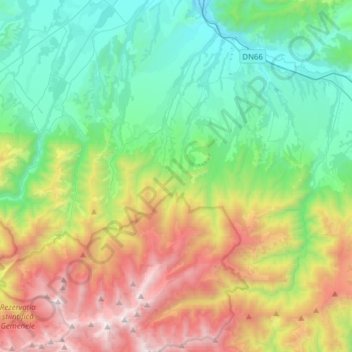
Name: Sălașu de Sus topographic map, elevation, terrain.
Location: Sălașu de Sus, Hunedoara, Romania (45.34934 22.85085 45.56603 23.08900)
Average elevation: 1,019 m
Minimum elevation: 314 m
Maximum elevation: 2,484 m
Other topographic maps
Click on a map to view its topography, its elevation and its terrain.
Sălașu de Sus
Romania > Hunedoara > Sălașu de Sus
Sălașu de Sus, Hunedoara, 337420, Romania
Average elevation: 491 m