
Thank you for supporting this site ❤️
Make a donation
Make a donation
Gear up for your next adventure:
As an Amazon Associate, this site earns from qualifying purchases at no extra cost to you.
Villaregia topographic map
Click on the map to display elevation.
Thank you for supporting this site ❤️
Make a donation
Make a donation
Gear up for your next adventure:
As an Amazon Associate, this site earns from qualifying purchases at no extra cost to you.
About this map
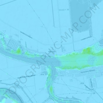
Name: Villaregia topographic map, elevation, terrain.
Location: Villaregia, Porto Viro, Rovigo, Veneto, 45019, Italië (44.93766 12.28126 44.97766 12.32126)
Average elevation: -2 m
Minimum elevation: -8 m
Maximum elevation: 9 m
Thank you for supporting this site ❤️
Make a donation
Make a donation
Gear up for your next adventure:
As an Amazon Associate, this site earns from qualifying purchases at no extra cost to you.