Geolocate

Middelburg topographic map

Click on the map to display elevation.

About this map

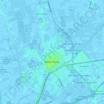
Name: Middelburg topographic map, elevation, terrain.

Location: Middelburg, Zeeland, Netherlands (51.47529 3.57530 51.53530 3.66034)

Average elevation: 0 m

Minimum elevation: -4 m

Maximum elevation: 8 m

Other topographic maps

Click on a map to view its topography, its elevation and its terrain.

Monnikendijk

Netherlands > Zeeland > Kattendijke

Average elevation: -2 m

Rancho Grande

Netherlands > Zeeland > Kamperland

Average elevation: 1 m

Pauluspolder

Netherlands > Zeeland > Hengstdijk

Average elevation: 0 m

Braamhul

Netherlands > Zeeland > Eede

Average elevation: 1 m

Zierikzee

Netherlands > Zeeland > Zierikzee > Zierikzee

Average elevation: -1 m

Gear up for your next adventure:

🧼Biodegradable Camp Soap - Environmentally friendly cleaning for gear and body
🧥Ultralight Puffy Jacket - Maximum warmth that packs down to the size of an orange
🔭Compact Binoculars - Lightweight optics for scouting trails and wildlife
Camping Coffee Maker - Brew fresh coffee anywhere on the topographic map
🦶Anti-Blister Balm - Prevents friction and hotspots during long ascents

As an Amazon Associate, this site earns from qualifying purchases at no extra cost to you.