Geolocate

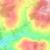
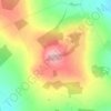
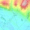
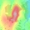
Bodal topographic map

Click on the map to display elevation.

About this map

Name: Bodal topographic map, elevation, terrain.

Location: Bodal, Gowran, The Municipal District of Castlecomer, County Kilkenny, Leinster, Ireland (52.60933 -7.09932 52.61842 -7.07814)

Average elevation: 72 m

Minimum elevation: 53 m

Maximum elevation: 87 m

Other topographic maps

Click on a map to view its topography, its elevation and its terrain.
Walton's Bog

Ireland > County Kilkenny

Average elevation: 66 m

Coon

Ireland > County Kilkenny

Average elevation: 221 m

Brandon Hill

Ireland > County Kilkenny

Brandon Hill (Irish: Cnoc Bhréanail) is the highest mountain in County Kilkenny, Ireland, with an elevation of 515 m (1,690 ft) and prominence at 448 m (1,470 ft). The South Leinster Way, a long-distance trail, meandering through the Barrow Valley and traverses Brandon Hill. The village of Graiguenamanagh and…

Average elevation: 294 m

Newmarket

Ireland > County Kilkenny > Newmarket

Average elevation: 93 m

Jenkinstown Park

Ireland > County Kilkenny

Average elevation: 77 m

Foyleatalure

Ireland > County Kilkenny

Average elevation: 216 m

Windgap

Ireland > County Kilkenny

Average elevation: 149 m

Finsboro

Ireland > County Kilkenny

Average elevation: 163 m

Ballyfoyle

Ireland > County Kilkenny

Average elevation: 120 m

Owning

Ireland > County Kilkenny

Average elevation: 97 m

Stonyford

Ireland > County Kilkenny

Average elevation: 64 m

Hugginstown

Ireland > County Kilkenny

Average elevation: 129 m

Cloghogue

Ireland > County Kilkenny

Average elevation: 152 m

Brandon Hill

Ireland > County Kilkenny

Brandon Hill (Irish: Cnoc Bhréanail) is the highest mountain in County Kilkenny, Ireland, with an elevation of 515 m (1,690 ft) and prominence at 448 m (1,470 ft). The South Leinster Way, a long-distance trail, meandering through the Barrow Valley and traverses Brandon Hill. The village of Graiguenamanagh and…

Average elevation: 294 m
Mount Alto

Ireland > County Kilkenny

Average elevation: 168 m

Gear up for your next adventure:

🔋Emergency Crank Radio - Weather alerts and power without needing batteries
🥾Trail Hiking Boots - Supportive boots for rough trails
🛰️Satellite Messenger - Emergency communication for areas with no cell service
🧭GPS Tracker - Track your location in remote areas safely
🧼Biodegradable Camp Soap - Environmentally friendly cleaning for gear and body

As an Amazon Associate, this site earns from qualifying purchases at no extra cost to you.