Geolocate

Batucan topographic map

Click on the map to display elevation.

About this map

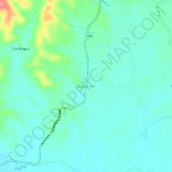
Name: Batucan topographic map, elevation, terrain.

Location: Batucan, Talacogon, Agusan del Sur, Caraga, 8510, Philippines (8.44862 125.81730 8.48862 125.85730)

Average elevation: 34 m

Minimum elevation: 16 m

Maximum elevation: 100 m

Gear up for your next adventure:

🧢Hiking Sun Hat - Wide-brimmed protection for exposed mountain ridges
🧭GPS Outdoor Watch - Smart watch for navigation and fitness tracking in nature
🥾Trail Hiking Shoes - Durable shoes designed for rugged trails
🥾Approach Boots - Comfortable boots for hiking and climbing approaches
💡LED Camping Lantern - Illuminate your campsite with long-lasting lanterns

As an Amazon Associate, this site earns from qualifying purchases at no extra cost to you.