Geolocate

Lester Beach topographic map

Click on the map to display elevation.

About this map
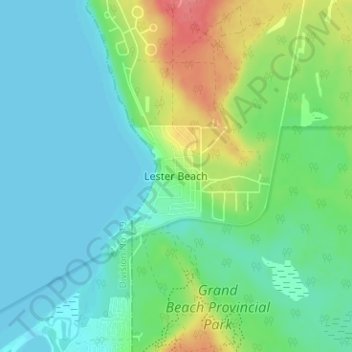
Name: Lester Beach topographic map, elevation, terrain.

Location: Lester Beach, Rural Municipality of Alexander, Manitoba, R0E 0E0, Canada (50.56637 -96.59551 50.60637 -96.55551)

Average elevation: 233 m

Minimum elevation: 215 m

Maximum elevation: 281 m

Rural Municipality of Alexander trails, hiking, mountain biking, running and outdoor activities

Gear up for your next adventure:

🧭Orienteering Kit - Tools for map reading and navigation in the wild
🧥Ultralight Puffy Jacket - Maximum warmth that packs down to the size of an orange
🛌Down Sleeping Bag - Superior warmth-to-weight ratio for cold nights
🥾Light Hiking Boots - Lightweight and comfortable boots for day hikes
🦟Insect Repellent - Keep mosquitoes and black flies away in wooded areas

As an Amazon Associate, this site earns from qualifying purchases at no extra cost to you.