

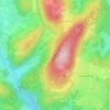
Traiskirchen topographic map
Click on the map to display elevation.
Traiskirchen
This observatory is the oldest in the state of Lower Austria and has been open to the public since 1967. It is unlike many observatories due to its location in the middle of the city and its low elevation, making it susceptible to the winter fog that plagues the region.
About this map

Name: Traiskirchen topographic map, elevation, terrain.
Location: Traiskirchen, Bezirk Baden, Lower Austria, Austria (47.97015 16.25591 48.04394 16.35602)
Average elevation: 219 m
Minimum elevation: 183 m
Maximum elevation: 574 m
Other topographic maps
Click on a map to view its topography, its elevation and its terrain.


Matterhorn
Austria > Lower Austria > Bezirk Baden > Altenmarkt an der Triesting
Average elevation: 526 m