Geolocate

Saguing topographic map

Click on the map to display elevation.

About this map
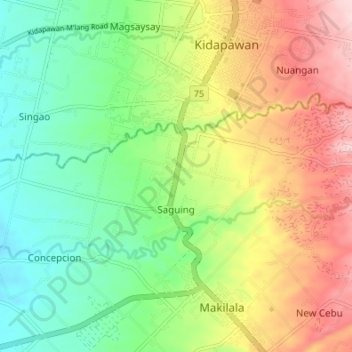
Name: Saguing topographic map, elevation, terrain.

Location: Saguing, Makilala, Cotabato, Soccsksargen, 9401, Philippines (6.96848 125.04744 6.99994 125.11525)

Average elevation: 237 m

Minimum elevation: 137 m

Maximum elevation: 380 m

Gear up for your next adventure:

🥾Lightweight Hiking Shoes - Comfortable shoes for day hikes
🧊Insulated Water Bottle - Keeps drinks cold in summer and prevents freezing in winter
🧦Outdoor Socks - Durable socks designed for hiking and outdoor sports
🌬️Windproof Camp Stove - Efficient cooking even on exposed mountain peaks
🔥Emergency Fire Starter - Reliable ignition source for all weather conditions

As an Amazon Associate, this site earns from qualifying purchases at no extra cost to you.