
Thank you for supporting this site ❤️
Make a donation
Make a donation
Gear up for your next adventure:
As an Amazon Associate, this site earns from qualifying purchases at no extra cost to you.
Moya topographic map
Click on the map to display elevation.
Thank you for supporting this site ❤️
Make a donation
Make a donation
Gear up for your next adventure:
As an Amazon Associate, this site earns from qualifying purchases at no extra cost to you.
About this map
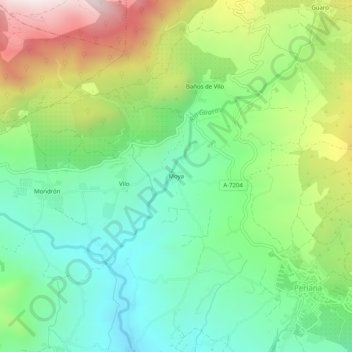
Name: Moya topographic map, elevation, terrain.
Location: Moya, Periana, La Axarquía, Málaga, Andalusië, 29710, Spanje (36.92133 -4.22963 36.96133 -4.18963)
Average elevation: 604 m
Minimum elevation: 295 m
Maximum elevation: 1,176 m
Thank you for supporting this site ❤️
Make a donation
Make a donation
Gear up for your next adventure:
As an Amazon Associate, this site earns from qualifying purchases at no extra cost to you.