Geolocate

Jati Padang topographic map

Click on the map to display elevation.

About this map
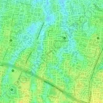
Name: Jati Padang topographic map, elevation, terrain.

Location: Jati Padang, Pasar Minggu, South Jakarta, Special Capital Region of Jakarta, 12540, Indonesia (-6.29939 106.82243 -6.27863 106.83937)

Average elevation: 36 m

Minimum elevation: 23 m

Maximum elevation: 49 m

Other topographic maps

Click on a map to view its topography, its elevation and its terrain.

Gear up for your next adventure:

🔦LED Headtorch - Bright and durable light for night activities
⛺Family Camping Tent - Spacious tent suitable for family camping trips
🗺️Topographic Maps - Detailed maps to explore trails, mountains, and wilderness areas
🔭Outdoor Binoculars - Lightweight binoculars for birdwatching and hiking
🦌Outdoor Trail Camera - Monitor wildlife activity near your favorite spots

As an Amazon Associate, this site earns from qualifying purchases at no extra cost to you.