Geolocate

Shilona topographic map

Click on the map to display elevation.

About this map

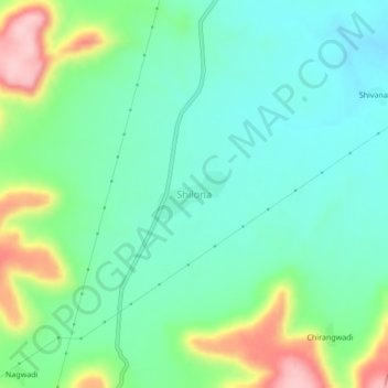
Name: Shilona topographic map, elevation, terrain.

Location: Shilona, Pusad, Yavatmal District, Maharashtra, India (19.73273 77.59111 19.77273 77.63111)

Average elevation: 374 m

Minimum elevation: 318 m

Maximum elevation: 513 m

Gear up for your next adventure:

🥾Hiking Shorts - Breathable shorts suitable for summer hikes
🧦Hiking Socks - Moisture-wicking and comfortable socks for long hikes
🛶Kayak Dry Bag - Waterproof storage for kayaking adventures
🧦Outdoor Socks - Durable socks designed for hiking and outdoor sports
🔨Vehicle Emergency Tool - Safety tool for remote road trips to trailheads

As an Amazon Associate, this site earns from qualifying purchases at no extra cost to you.