Geolocate

Nova topographic map

Click on the map to display elevation.

About this map
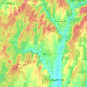
Name: Nova topographic map, elevation, terrain.

Location: Nova, Lenti járás, Zala, Transdanubia, 8948, Hungary (46.65342 16.61841 46.73671 16.72652)

Average elevation: 208 m

Minimum elevation: 165 m

Maximum elevation: 263 m

Gear up for your next adventure:

⛺Camping Essentials - All-in-one gear for a comfortable camping trip
🥾Mountain Trail Shoes - High-traction shoes for mountain trails
🔦UV Flashlight - Detect minerals or specific insects in the dark
🕯️Camping Lantern - Illuminates your entire campsite with high-efficiency LEDs
🚲Handlebar Phone Mount - View topographic-map.com live while cycling

As an Amazon Associate, this site earns from qualifying purchases at no extra cost to you.