Geolocate

King Country topographic map

Click on the map to display elevation.

About this map
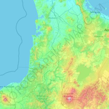
Name: King Country topographic map, elevation, terrain.

Location: King Country, Waitomo District, Waikato, New Zealand (-39.46595 174.21583 -37.46595 176.21583)

Average elevation: 296 m

Minimum elevation: 0 m

Maximum elevation: 2,717 m

Other topographic maps

Click on a map to view its topography, its elevation and its terrain.

Awakino River

New Zealand > Waikato > Waitomo District

Average elevation: 217 m

Gear up for your next adventure:

🧴Bear Spray Holster - Quick-access carry for essential Canadian wilderness safety
🧥Waterproof Pants - Keep dry during rainy hiking conditions
🥾Hiking Boots - Sturdy boots providing ankle support and traction on rugged trails
🧦Crew Hiking Socks - Comfortable socks for long-distance hikes
🥾Waterproof Hiking Boots - Boots keeping your feet dry in wet conditions

As an Amazon Associate, this site earns from qualifying purchases at no extra cost to you.