Geolocate

Kentstown topographic map

Click on the map to display elevation.

About this map
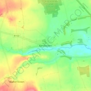
Name: Kentstown topographic map, elevation, terrain.

Location: Kentstown, The Municipal District of Ashbourne, County Meath, Leinster, Ireland (53.60720 -6.55279 53.64720 -6.51279)

Average elevation: 63 m

Minimum elevation: 32 m

Maximum elevation: 103 m

Other topographic maps

Click on a map to view its topography, its elevation and its terrain.

Gear up for your next adventure:

🩹Moleskin Blister Pads - Direct protection for painful foot pressure points
🧢Hiking Sun Hat - Wide-brimmed protection for exposed mountain ridges
👟Trail Running Shoes - Agile footwear for fast-paced topographic exploration
🛌Insulated Sleeping Pad - Critical thermal barrier between you and the cold ground
🧥Softshell Hiking Jacket - The perfect balance of wind protection and breathability

As an Amazon Associate, this site earns from qualifying purchases at no extra cost to you.