Geolocate

Neira topographic map

Click on the map to display elevation.

About this map

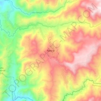
Name: Neira topographic map, elevation, terrain.

Location: Neira, Centrosur, Caldas, 171001, Colombia (5.12741 -75.56097 5.20741 -75.48097)

Average elevation: 1,738 m

Minimum elevation: 1,190 m

Maximum elevation: 2,262 m

Gear up for your next adventure:

🧥Softshell Jacket - Windproof and breathable jacket for hiking
🧦Hiking Socks - Moisture-wicking and comfortable socks for long hikes
🧴First Aid Kit - Essential first aid supplies for outdoor emergencies
🦶Anti-Blister Balm - Prevents friction and hotspots during long ascents
🧊Insulated Water Bottle - Keeps drinks cold in summer and prevents freezing in winter

As an Amazon Associate, this site earns from qualifying purchases at no extra cost to you.