Geolocate

Hamzabey topographic map

Click on the map to display elevation.

About this map
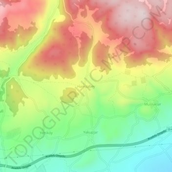
Name: Hamzabey topographic map, elevation, terrain.

Location: Hamzabey, Bolu, Black Sea Region, Turkey (40.76452 31.63746 40.80452 31.67746)

Average elevation: 955 m

Minimum elevation: 728 m

Maximum elevation: 1,194 m

Gear up for your next adventure:

🥾Hiking Shorts - Breathable shorts suitable for summer hikes
🛏️Camping Sleeping Mat - Comfortable mats for sleeping outdoors
🚲MTB Frame Bag - Carry tools and maps directly on your bicycle frame
🧢Hiking Sun Hat - Wide-brimmed protection for exposed mountain ridges
🩹Compact First Aid Kit - Pre-packed essentials for common trail injuries

As an Amazon Associate, this site earns from qualifying purchases at no extra cost to you.