Geolocate

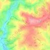
Les Landes topographic map

Click on the map to display elevation.

About this map

Name: Les Landes topographic map, elevation, terrain.

Location: Les Landes, Plémet, Saint-Brieuc, Côtes-d'Armor, Bretagne, France métropolitaine, 22210, France (48.14159 -2.61512 48.18159 -2.57512)

Average elevation: 150 m

Minimum elevation: 89 m

Maximum elevation: 192 m

Other topographic maps

Click on a map to view its topography, its elevation and its terrain.

Plémet

France > Bretagne > Côtes-d'Armor > Plémet

Average elevation: 153 m

La Ferrière

France > Bretagne > Côtes-d'Armor > Plémet

Average elevation: 133 m

Gear up for your next adventure:

🥾Hiking Boots - Sturdy boots providing ankle support and traction on rugged trails
🥾Trail Running Shoes - Lightweight and durable shoes for trail running
🛌Down Sleeping Bag - Superior warmth-to-weight ratio for cold nights
🦯Trekking Poles - Reduced impact on joints for steep topographic climbs
💧Hydration Pack - Hands-free hydration system for long hikes

As an Amazon Associate, this site earns from qualifying purchases at no extra cost to you.