Geolocate

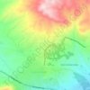
Kavakpınar topographic map

Click on the map to display elevation.

About this map

Name: Kavakpınar topographic map, elevation, terrain.

Location: Kavakpınar, Elâzığ, Elazığ, Eastern Anatolia Region, Turkey (38.68470 38.95810 38.72470 38.99810)

Average elevation: 1,235 m

Minimum elevation: 1,091 m

Maximum elevation: 1,471 m

Other topographic maps

Click on a map to view its topography, its elevation and its terrain.

Lake Hazar

Turkey > Elazığ

Average elevation: 1,340 m

Hilalkent Mahallesi

Turkey > Elazığ

Average elevation: 1,136 m

Çaydaçıra Mahallesi

Turkey > Elazığ

Average elevation: 1,217 m

Gear up for your next adventure:

🧰Multitool Knife - Compact and versatile tool for outdoor use
🔦UV Flashlight - Detect minerals or specific insects in the dark
📷Outdoor Action Camera - Capture high-elevation views and rugged adventures
🚲MTB Frame Bag - Carry tools and maps directly on your bicycle frame
👟Trail Running Shoes - Agile footwear for fast-paced topographic exploration

As an Amazon Associate, this site earns from qualifying purchases at no extra cost to you.