Geolocate

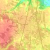
Montpelier topographic map

Click on the map to display elevation.

About this map

Name: Montpelier topographic map, elevation, terrain.

Location: Montpelier, Hanover County, Virginia, 23192, United States (37.80125 -77.70443 37.84125 -77.66443)

Average elevation: 90 m

Minimum elevation: 61 m

Maximum elevation: 106 m

Other topographic maps

Click on a map to view its topography, its elevation and its terrain.
Ashland

United States > Virginia > Hanover County

Average elevation: 66 m

Ashland

United States > Virginia > Hanover County

Average elevation: 66 m

Gear up for your next adventure:

💡LED Headlamp - Hands-free illumination for night hiking and camping
📷Outdoor Action Camera - Capture high-elevation views and rugged adventures
🥾Light Hiking Boots - Lightweight and comfortable boots for day hikes
🔥Camping Stove - Portable stoves to cook outdoors with ease
🔋Emergency Crank Radio - Weather alerts and power without needing batteries

As an Amazon Associate, this site earns from qualifying purchases at no extra cost to you.