
Acton topographic map
Click on the map to display elevation.
About this map
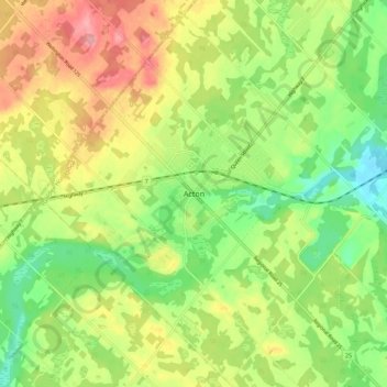
Name: Acton topographic map, elevation, terrain.
Location: Acton, Halton Hills, Halton Region, Ontario, L7J 1W1, Canada (43.58970 -80.08147 43.66970 -80.00147)
Average elevation: 362 m
Minimum elevation: 310 m
Maximum elevation: 427 m
Halton Region trails, hiking, mountain biking, running and outdoor activities
Other topographic maps
Click on a map to view its topography, its elevation and its terrain.
Milton East—Halton Hills South
Canada > Ontario > Halton Region > Glen Williams
Average elevation: 252 m