Geolocate

Pockau topographic map

Click on the map to display elevation.

About this map

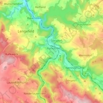
Name: Pockau topographic map, elevation, terrain.

Location: Pockau, Pockau-Lengefeld, Erzgebirgskreis, Sachsen, 09509, Deutschland (50.66157 13.19312 50.74406 13.31214)

Average elevation: 518 m

Minimum elevation: 361 m

Maximum elevation: 700 m

Other topographic maps

Click on a map to view its topography, its elevation and its terrain.

Gear up for your next adventure:

🧣Evaporative Cooling Towel - Beat the heat during intense summer climbs
🧰Emergency Multi-Tool - Compact multi-tool for outdoor survival
🥾Hiking Shorts - Breathable shorts suitable for summer hikes
🧥Waterproof Jacket - Lightweight rain jackets for hiking and outdoor activities
🧢Outdoor Visor - Breathable visor for sunny hikes

As an Amazon Associate, this site earns from qualifying purchases at no extra cost to you.