Geolocate

Wilmington topographic map

Click on the map to display elevation.

About this map

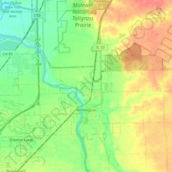
Name: Wilmington topographic map, elevation, terrain.

Location: Wilmington, Will County, Illinois, 60481, United States (41.27312 -88.23561 41.37606 -88.07558)

Average elevation: 175 m

Minimum elevation: 151 m

Maximum elevation: 208 m

Gear up for your next adventure:

🐕Hiking Dog Pack - Let your canine companion carry their own water and food
🔦LED Headlamp - Hands-free lighting for early morning starts or late finishes
📷Outdoor Action Camera - Capture high-elevation views and rugged adventures
🧦Hiking Liner Socks - Thin base layer to prevent friction and blisters
🥾Mountain Trail Shoes - High-traction shoes for mountain trails

As an Amazon Associate, this site earns from qualifying purchases at no extra cost to you.