Geolocate

Oppland topographic map

Click on the map to display elevation.

About this map

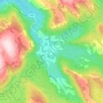
Name: Oppland topographic map, elevation, terrain.

Location: Oppland, Flatanger, Trøndelag, 7745, Norway (64.31757 10.84470 64.35757 10.88470)

Average elevation: 204 m

Minimum elevation: 36 m

Maximum elevation: 444 m

Gear up for your next adventure:

🛁Quick-Dry Microfiber Towel - Space-saving towel that dries rapidly on the move
🔥Camping Stove - Portable stoves to cook outdoors with ease
🥾Lightweight Hiking Boots - Boots for comfort and mobility on long hikes
🧰Multitool Knife - Compact and versatile tool for outdoor use
🔦LED Headlamp - Hands-free lighting for early morning starts or late finishes

As an Amazon Associate, this site earns from qualifying purchases at no extra cost to you.