Geolocate

Castromediano topographic map

Click on the map to display elevation.

About this map

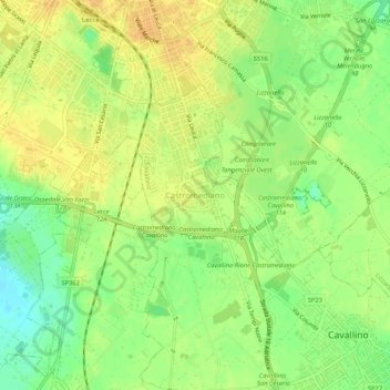
Name: Castromediano topographic map, elevation, terrain.

Location: Castromediano, Cavallino, Lecce, Puglia, 73016, Italia (40.30686 18.15977 40.34686 18.19977)

Average elevation: 43 m

Minimum elevation: 25 m

Maximum elevation: 55 m

Gear up for your next adventure:

🧦Crew Hiking Socks - Comfortable socks for long-distance hikes
Camping Tent - Weather-resistant tents suitable for 2 to 6 people
🧭GPS Outdoor Watch - Smart watch for navigation and fitness tracking in nature
💡Compact LED Flashlight - Powerful and portable flashlight for outdoor use
🔋Solar Power Bank - Keep your GPS and devices charged during long outdoor trips

As an Amazon Associate, this site earns from qualifying purchases at no extra cost to you.