Geolocate

Shizuo topographic map

Click on the map to display elevation.

About this map

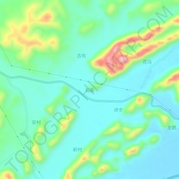
Name: Shizuo topographic map, elevation, terrain.

Location: Shizuo, Laibin, Guangxi, China (23.36550 109.50300 23.40550 109.54300)

Average elevation: 169 m

Minimum elevation: 105 m

Maximum elevation: 357 m

Gear up for your next adventure:

🛶Kayak Dry Bag - Waterproof storage for kayaking adventures
🔭Outdoor Binoculars - Lightweight binoculars for birdwatching and hiking
🚲Handlebar Phone Mount - View topographic-map.com live while cycling
🧰Emergency Multi-Tool - Compact multi-tool for outdoor survival
🧦Crew Hiking Socks - Comfortable socks for long-distance hikes

As an Amazon Associate, this site earns from qualifying purchases at no extra cost to you.