Albuquerque topographic map
Click on the map to display elevation.
Albuquerque
Located in north-central New Mexico, Albuquerque serves as the county seat of Bernalillo County. To its east are the Sandia–Manzano Mountains, Rio Grande flows north to south through its center, while the West Mesa and Petroglyph National Monument make up the western part of the city. Albuquerque has one of the highest elevations of any major city in the U.S., ranging from 4,900 feet (1,500 m) above sea level near the Rio Grande to over 6,700 feet (2,000 m) in the foothill areas of Sandia Heights and Glenwood Hills. The civic apex is found in an undeveloped area within the Albuquerque Open Space; there, the terrain rises to an elevation of approximately 6,880 feet (2,100 m), and the metropolitan area's highest point is the Sandia Mountains crest at an altitude of 10,678 feet (3,255 m).
About this map
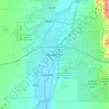
Name: Albuquerque topographic map, elevation, terrain.
Average elevation: 1,671 m
Minimum elevation: 1,491 m
Maximum elevation: 3,162 m
Other topographic maps
Click on a map to view its topography, its elevation and its terrain.