Geolocate

Olderdalen topographic map

Click on the map to display elevation.

About this map

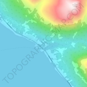
Name: Olderdalen topographic map, elevation, terrain.

Location: Olderdalen, Kåfjord, Troms og Finnmark, 9146, Norway (69.58459 20.52017 69.62459 20.56017)

Average elevation: 212 m

Minimum elevation: -2 m

Maximum elevation: 1,157 m

Gear up for your next adventure:

🧳Compression Sacks - Maximize space in your backpack by shrinking gear
🧦Thermal Socks - Warm socks for winter hiking or camping
🧥Waterproof Hiking Jacket - Protect yourself from rain and wind while hiking
🧴Outdoor Sunscreen - High SPF protection for high-altitude UV exposure
👟Trail Running Shoes - Agile footwear for fast-paced topographic exploration

As an Amazon Associate, this site earns from qualifying purchases at no extra cost to you.