Geolocate

Downtown topographic map

Click on the map to display elevation.

About this map

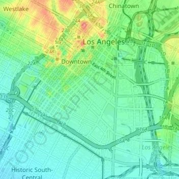
Name: Downtown topographic map, elevation, terrain.

Location: Downtown, Los Angeles, California, United States (34.01471 -118.27397 34.06535 -118.22292)

Average elevation: 84 m

Minimum elevation: 59 m

Maximum elevation: 155 m

Other topographic maps

Click on a map to view its topography, its elevation and its terrain.

Gear up for your next adventure:

🧦Merino Wool Socks - Moisture-wicking comfort for long-distance hiking
🧊Insulated Water Bottle - Keeps drinks cold in summer and prevents freezing in winter
🧤Insulated Winter Gloves - Heavy-duty protection for sub-zero Canadian adventures
🐕Hiking Dog Pack - Let your canine companion carry their own water and food
🧥Ultralight Puffy Jacket - Maximum warmth that packs down to the size of an orange

As an Amazon Associate, this site earns from qualifying purchases at no extra cost to you.