Geolocate

Saur topographic map

Click on the map to display elevation.

About this map

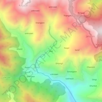
Name: Saur topographic map, elevation, terrain.

Location: Saur, Tehri, Tehri Garhwal, Uttarakhand, India (30.37744 78.31387 30.41744 78.35387)

Average elevation: 1,894 m

Minimum elevation: 1,345 m

Maximum elevation: 2,440 m

Gear up for your next adventure:

🧼Biodegradable Camp Soap - Environmentally friendly cleaning for gear and body
🛌Down Sleeping Bag - Superior warmth-to-weight ratio for cold nights
🔥Camping Stove - Portable stoves to cook outdoors with ease
🗺️Topographic Maps - Detailed maps to explore trails, mountains, and wilderness areas
🪑Insulated Seat Pad - Protect your seat from cold rocks and wet logs

As an Amazon Associate, this site earns from qualifying purchases at no extra cost to you.