
Thank you for supporting this site ❤️
Make a donation
Make a donation
Gear up for your next adventure:
As an Amazon Associate, this site earns from qualifying purchases at no extra cost to you.
Cerritos topographic map
Click on the map to display elevation.
Thank you for supporting this site ❤️
Make a donation
Make a donation
Gear up for your next adventure:
As an Amazon Associate, this site earns from qualifying purchases at no extra cost to you.
About this map
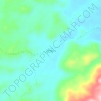
Name: Cerritos topographic map, elevation, terrain.
Location: Cerritos, El Retorno, Guaviare, RAP Amazonía, Colombia (2.30909 -72.78090 2.34909 -72.74090)
Average elevation: 265 m
Minimum elevation: 206 m
Maximum elevation: 463 m
Thank you for supporting this site ❤️
Make a donation
Make a donation
Gear up for your next adventure:
As an Amazon Associate, this site earns from qualifying purchases at no extra cost to you.