Geolocate

Fruit Valley topographic map

Click on the map to display elevation.

About this map

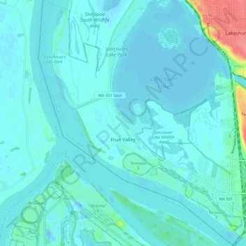
Name: Fruit Valley topographic map, elevation, terrain.

Location: Fruit Valley, Vancouver, Clark County, Washington, United States (45.62469 -122.77456 45.69800 -122.68641)

Average elevation: 9 m

Minimum elevation: -9 m

Maximum elevation: 74 m

Other topographic maps

Click on a map to view its topography, its elevation and its terrain.

Gear up for your next adventure:

🥽Outdoor Goggles - Protective eyewear for outdoor activities
🏃Hydration Running Vest - Carry water and maps close to your body for speed
🧥Fleece Jacket - Warm and lightweight jacket for layering
🔥Emergency Fire Starter - Reliable ignition source for all weather conditions
🔋Lithium AA Batteries - Long-lasting power that performs in extreme cold

As an Amazon Associate, this site earns from qualifying purchases at no extra cost to you.