Geolocate

Collinsville topographic map

Click on the map to display elevation.

About this map

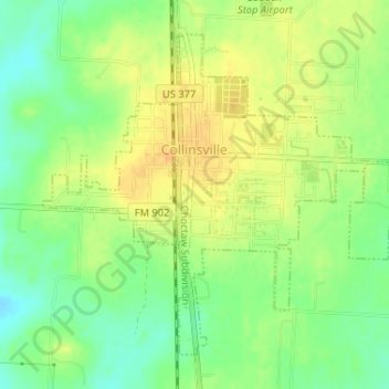
Name: Collinsville topographic map, elevation, terrain.

Location: Collinsville, Grayson County, Texas, United States (33.54722 -96.92375 33.56948 -96.89242)

Average elevation: 221 m

Minimum elevation: 204 m

Maximum elevation: 234 m

Gear up for your next adventure:

🧥Softshell Hiking Jacket - The perfect balance of wind protection and breathability
🛌Insulated Sleeping Pad - Critical thermal barrier between you and the cold ground
💧Reusable Water Bottle - Durable water bottles for hydration on trails
🛏️Camping Sleeping Mat - Comfortable mats for sleeping outdoors
🧢Hiking Sun Hat - Wide-brimmed protection for exposed mountain ridges

As an Amazon Associate, this site earns from qualifying purchases at no extra cost to you.