Geolocate

Wrightwood topographic map

Click on the map to display elevation.

Wrightwood

Wrightwood is a census-designated place in San Bernardino County, California. It sits at an elevation of 5,935 feet (1,809 m). The population was 4,525 at the 2010 census, up from the population of 3,837 at the 2000 census. Wrightwood is located 77 miles northeast of Los Angeles.

About this map

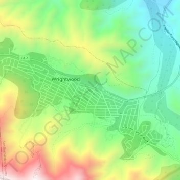
Name: Wrightwood topographic map, elevation, terrain.

Location: Wrightwood, Lone Pine Canyon Road, Wrightwood, San Bernardino County, California, 92396, United States (34.34290 -117.65315 34.37380 -117.60562)

Average elevation: 1,904 m

Minimum elevation: 1,549 m

Maximum elevation: 2,474 m

Gear up for your next adventure:

🧥Waterproof Pants - Keep dry during rainy hiking conditions
🍽️Titanium Camping Spork - Ultralight and indestructible eating utensil
🛰️Satellite Messenger - Emergency communication for areas with no cell service
🥾Mountaineering Boots - Supportive boots for climbing and high-altitude hiking
🧤Thermal Hiking Gloves - Grip-enhanced gloves for cold-weather altitude trekking

As an Amazon Associate, this site earns from qualifying purchases at no extra cost to you.