Geolocate

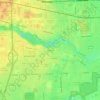
Sumpter Township topographic map

Click on the map to display elevation.

About this map

Name: Sumpter Township topographic map, elevation, terrain.

Location: Sumpter Township, Wayne County, Michigan, United States (42.08560 -83.54238 42.17665 -83.42063)

Average elevation: 201 m

Minimum elevation: 187 m

Maximum elevation: 230 m

Other topographic maps

Click on a map to view its topography, its elevation and its terrain.
Perrinville

United States > Michigan > Wayne County > Westland

Average elevation: 195 m

Palmer Park

United States > Michigan > Wayne County > Detroit

Average elevation: 198 m

Sunnyside

United States > Michigan > Wayne County > Romulus

Average elevation: 194 m

Elm

United States > Michigan > Wayne County > Livonia

Average elevation: 195 m

Calvert Park

United States > Michigan > Wayne County > Detroit

Average elevation: 196 m

Newburg

United States > Michigan > Wayne County > Livonia

Average elevation: 209 m

Gear up for your next adventure:

🧰Multitool Knife - Compact and versatile tool for outdoor use
🔦LED Headlamp - Hands-free lighting for early morning starts or late finishes
🧥Fleece Jacket - Warm and lightweight jacket for layering
🔋Lithium AA Batteries - Long-lasting power that performs in extreme cold
🔦LED Flashlight - Powerful and long-lasting flashlight for camping and emergencies

As an Amazon Associate, this site earns from qualifying purchases at no extra cost to you.