Geolocate

Bhimavaram topographic map

Click on the map to display elevation.

About this map

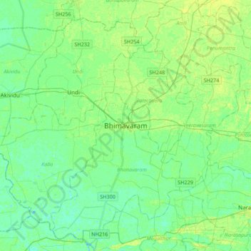
Name: Bhimavaram topographic map, elevation, terrain.

Location: Bhimavaram, West Godavari, Andhra Pradesh, 534200, India (16.38277 81.36734 16.70277 81.68734)

Average elevation: 6 m

Minimum elevation: -1 m

Maximum elevation: 13 m

Gear up for your next adventure:

🧦Outdoor Socks - Durable socks designed for hiking and outdoor sports
🔦LED Headlamp - Hands-free lighting for early morning starts or late finishes
🧢Hiking Hat - Sun-protective and breathable hats for long treks
🥾Light Trekking Boots - Supportive boots for multi-day treks
🧦Merino Wool Socks - Moisture-wicking comfort for long-distance hiking

As an Amazon Associate, this site earns from qualifying purchases at no extra cost to you.