Geolocate

Riverbend topographic map

Click on the map to display elevation.

About this map

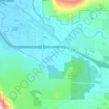
Name: Riverbend topographic map, elevation, terrain.

Location: Riverbend, King County, Washington, United States (47.45487 -121.79365 47.48474 -121.71615)

Average elevation: 234 m

Minimum elevation: 131 m

Maximum elevation: 920 m

Gear up for your next adventure:

🥾Mountain Hiking Boots - High-traction boots for rocky terrain
🧢Hiking Hat - Sun-protective and breathable hats for long treks
🥾Mountaineering Boots - Supportive boots for climbing and high-altitude hiking
🍽️Titanium Camping Spork - Ultralight and indestructible eating utensil
🕶️Polarized Sunglasses - Protect your eyes with durable polarized lenses

As an Amazon Associate, this site earns from qualifying purchases at no extra cost to you.