
Thank you for supporting this site ❤️
Make a donation
Make a donation
Gear up for your next adventure:
As an Amazon Associate, this site earns from qualifying purchases at no extra cost to you.
Yeniceoba topographic map
Click on the map to display elevation.
Thank you for supporting this site ❤️
Make a donation
Make a donation
Gear up for your next adventure:
As an Amazon Associate, this site earns from qualifying purchases at no extra cost to you.
About this map
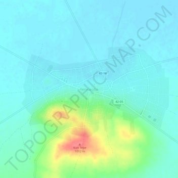
Name: Yeniceoba topographic map, elevation, terrain.
Location: Yeniceoba, Cihanbeyli, Konya, Central Anatolia Region, Turkey (38.85118 32.76928 38.89118 32.80928)
Average elevation: 962 m
Minimum elevation: 949 m
Maximum elevation: 1,012 m
Thank you for supporting this site ❤️
Make a donation
Make a donation
Gear up for your next adventure:
As an Amazon Associate, this site earns from qualifying purchases at no extra cost to you.