
Bulverde topographic map
Interactive map
Click on the map to display elevation.
About this map
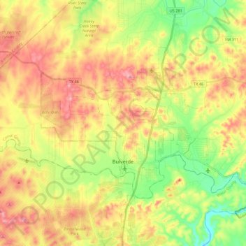
Name: Bulverde topographic map, elevation, terrain.
Location: Bulverde, Comal County, Texas, États-Unis d'Amérique (29.71563 -98.52530 29.83061 -98.31001)
Average elevation: 364 m
Minimum elevation: 267 m
Maximum elevation: 468 m