Geolocate

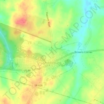
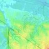
Middleburg topographic map

Click on the map to display elevation.

Middleburg

According to the United States Census Bureau, the town has a total area of 0.6 square mile (1.5 km2), all land. The elevation is 486 feet.

Wikipedia (CC-BY-SA 3.0)

About this map

Name: Middleburg topographic map, elevation, terrain.

Location: Middleburg, Loudoun County, Virginia, 20118, United States (38.96298 -77.75946 38.98059 -77.72547)

Average elevation: 143 m

Minimum elevation: 113 m

Maximum elevation: 173 m

Other topographic maps

Click on a map to view its topography, its elevation and its terrain.
Lucketts

United States > Virginia > Loudoun County

Average elevation: 105 m

Bluemont

United States > Virginia > Loudoun County

Average elevation: 279 m

Loudoun Valley Estates

United States > Virginia > Loudoun County

The land around Loudoun Valley Estates is gently rolling. The average elevation is 289 feet (88 m). The population density is about 500 people per square kilometer.

Average elevation: 91 m
Sterling

United States > Virginia > Loudoun County

Average elevation: 94 m

Ashburn

United States > Virginia > Loudoun County

Average elevation: 87 m

Paris Mountain

United States > Virginia > Loudoun County

Paris Mountain is a peak of Blue Ridge Mountain on the border of Loudoun County and Clarke County in Virginia. The 1,926 feet (587 m) peak, which is located just north of Ashby's Gap and the town of Paris, for which it is named, represents the highest elevation in both counties. The peak is accessible by Blue…

Average elevation: 452 m

Aldie

United States > Virginia > Loudoun County

Average elevation: 119 m

Lansdowne

United States > Virginia > Loudoun County

Average elevation: 85 m

Belmont

United States > Virginia > Loudoun County

Average elevation: 93 m

Sterling

United States > Virginia > Loudoun County

Average elevation: 94 m

Ashburn

United States > Virginia > Loudoun County

Average elevation: 87 m

Countryside

United States > Virginia > Loudoun County

Average elevation: 75 m

Aldie

United States > Virginia > Loudoun County

Average elevation: 127 m

South Riding

United States > Virginia > Loudoun County

Average elevation: 93 m

Gear up for your next adventure:

🥾Trail Hiking Boots - Supportive boots for rough trails
🔦LED Flashlight - Powerful and long-lasting flashlight for camping and emergencies
🐕Hiking Dog Pack - Let your canine companion carry their own water and food
🚲Bike Repair Kit - Essential tools for on-trail mechanical issues
👟Trail Running Shoes - Agile footwear for fast-paced topographic exploration

As an Amazon Associate, this site earns from qualifying purchases at no extra cost to you.