Geolocate

Bagbag topographic map

Click on the map to display elevation.

About this map

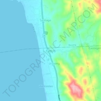
Name: Bagbag topographic map, elevation, terrain.

Location: Bagbag, Caba, La Union, Ilocos Region, 2501, Philippines (16.44929 120.31469 16.48929 120.35469)

Average elevation: 33 m

Minimum elevation: -1 m

Maximum elevation: 168 m

Gear up for your next adventure:

🧦Crew Hiking Socks - Comfortable socks for long-distance hikes
🎒Hiking Daypack - Lightweight and durable backpacks for day trips and excursions
🚲Heavy Duty Bike Lock - Secure your bike at the trailhead or during stops
Lightweight Camping Tent - Portable shelter optimized for Canadian backcountry camping
🛶Canoe Life Vest - Safety vest for water sports

As an Amazon Associate, this site earns from qualifying purchases at no extra cost to you.