
Videle topographic map
Click on the map to display elevation.
About this map
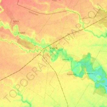
Name: Videle topographic map, elevation, terrain.
Location: Videle, Teleorman, Romania (44.21497 25.47022 44.32085 25.64469)
Average elevation: 105 m
Minimum elevation: 79 m
Maximum elevation: 117 m
Other topographic maps
Click on a map to view its topography, its elevation and its terrain.
Turnu Măgurele
A ferry plies across the Danube to the Bulgarian city of Nikopol. There are some vestiges of a Roman bridge across the Danube, built in 330 by Constantine the Great. It is built in the Danube plain in a fertile land called the Burnaz Plain [ro]. At 4 km (2.5 mi) south-west from it the river Olt joins the…
Average elevation: 75 m