Geolocate

Kayenta topographic map

Click on the map to display elevation.

About this map

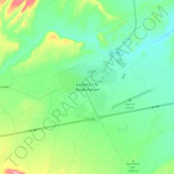
Name: Kayenta topographic map, elevation, terrain.

Location: Kayenta, Navajo County, Arizona, United States (36.68185 -110.29387 36.76185 -110.21387)

Average elevation: 1,752 m

Minimum elevation: 1,664 m

Maximum elevation: 1,980 m

Gear up for your next adventure:

🕶️Polarized Sunglasses - Protect your eyes with durable polarized lenses
🧥Waterproof Jacket - Lightweight rain jackets for hiking and outdoor activities
👟Trail Running Shoes - Agile footwear for fast-paced topographic exploration
🧥Thermal Layer - Insulating layer for cold outdoor conditions
🦟Insect Repellent - Keep mosquitoes and black flies away in wooded areas

As an Amazon Associate, this site earns from qualifying purchases at no extra cost to you.