Geolocate

San Carlos topographic map

Click on the map to display elevation.

About this map

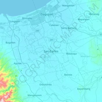
Name: San Carlos topographic map, elevation, terrain.

Location: San Carlos, Pangasinan, Ilocos Region, 2420, Philippines (15.76677 120.18756 16.08677 120.50756)

Average elevation: 27 m

Minimum elevation: -1 m

Maximum elevation: 650 m

Gear up for your next adventure:

🥽Outdoor Goggles - Protective eyewear for outdoor activities
🧢Outdoor Cap - Protective cap for sun and rain during hikes
💧Hydration Pack - Hands-free hydration system for long hikes
🧦Hiking Socks - Moisture-wicking and comfortable socks for long hikes
📷Outdoor Action Camera - Capture high-elevation views and rugged adventures

As an Amazon Associate, this site earns from qualifying purchases at no extra cost to you.