
Thank you for supporting this site ❤️
Make a donation
Make a donation
Gear up for your next adventure:
As an Amazon Associate, this site earns from qualifying purchases at no extra cost to you.
Portete topographic map
Click on the map to display elevation.
Thank you for supporting this site ❤️
Make a donation
Make a donation
Gear up for your next adventure:
As an Amazon Associate, this site earns from qualifying purchases at no extra cost to you.
About this map
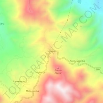
Name: Portete topographic map, elevation, terrain.
Location: Portete, Nambacola, Gonzanama, Loja, Ecuador (-4.15023 -79.42426 -4.11023 -79.38426)
Average elevation: 1,899 m
Minimum elevation: 1,423 m
Maximum elevation: 2,359 m
Thank you for supporting this site ❤️
Make a donation
Make a donation
Gear up for your next adventure:
As an Amazon Associate, this site earns from qualifying purchases at no extra cost to you.