Geolocate

Suray topographic map

Click on the map to display elevation.

About this map

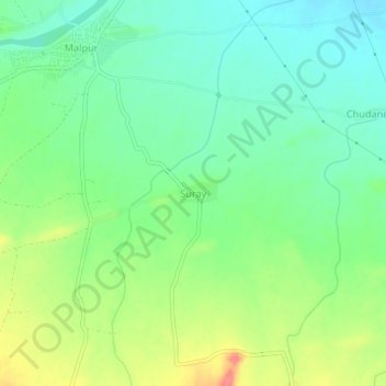
Name: Suray topographic map, elevation, terrain.

Location: Suray, Sindkhede, Dhule, Maharashtra, India (21.24476 74.50359 21.28476 74.54359)

Average elevation: 215 m

Minimum elevation: 190 m

Maximum elevation: 259 m

Gear up for your next adventure:

🧥Thermal Layer - Insulating layer for cold outdoor conditions
🌡️Emergency Mylar Blankets - Compact thermal protection for unexpected nights outdoors
🧴Insect Repellent - Protect yourself from bugs during outdoor adventures
🧢Beanie Hat - Keep your head warm in cold weather
🏕️Camping Hammock - Integrated protection for sleeping between trees

As an Amazon Associate, this site earns from qualifying purchases at no extra cost to you.