Geolocate

Bidwell topographic map

Click on the map to display elevation.

About this map

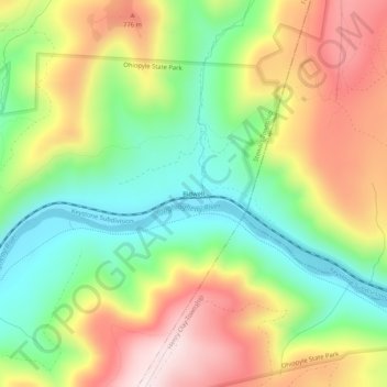
Name: Bidwell topographic map, elevation, terrain.

Location: Bidwell, Stewart Township, Fayette County, Pennsylvania, United States (39.83619 -79.44448 39.87619 -79.40448)

Average elevation: 605 m

Minimum elevation: 378 m

Maximum elevation: 890 m

Other topographic maps

Click on a map to view its topography, its elevation and its terrain.

Gear up for your next adventure:

🧦Hiking Socks - Moisture-wicking and comfortable socks for long hikes
🧭Orienteering Kit - Tools for map reading and navigation in the wild
🥾Durable Hiking Shoes - Long-lasting shoes for frequent hiking
Bushcraft Tarp - Versatile emergency shelter or gear protection
🪜Heavy Duty Carabiners - Multi-use clips for securing gear to your backpack

As an Amazon Associate, this site earns from qualifying purchases at no extra cost to you.