
Kjeller topographic map
Click on the map to display elevation.
About this map
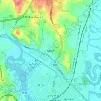
Name: Kjeller topographic map, elevation, terrain.
Location: Kjeller, Lillestrøm, Viken, 2007, Norway (59.95387 11.02759 59.99387 11.06759)
Average elevation: 121 m
Minimum elevation: 98 m
Maximum elevation: 204 m
Other topographic maps
Click on a map to view its topography, its elevation and its terrain.