
Thank you for supporting this site ❤️
Make a donation
Make a donation
Gear up for your next adventure:
As an Amazon Associate, this site earns from qualifying purchases at no extra cost to you.
McGaffey topographic map
Click on the map to display elevation.
Thank you for supporting this site ❤️
Make a donation
Make a donation
Gear up for your next adventure:
As an Amazon Associate, this site earns from qualifying purchases at no extra cost to you.
About this map
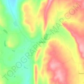
Name: McGaffey topographic map, elevation, terrain.
Location: McGaffey, McKinley County, New Mexico, United States (35.35530 -108.53563 35.39530 -108.49563)
Average elevation: 2,412 m
Minimum elevation: 2,336 m
Maximum elevation: 2,478 m
Thank you for supporting this site ❤️
Make a donation
Make a donation
Gear up for your next adventure:
As an Amazon Associate, this site earns from qualifying purchases at no extra cost to you.