Geolocate

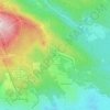
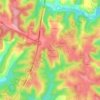
Tarn topographic map

Click on the map to display elevation.

About this map

Name: Tarn topographic map, elevation, terrain.

Location: Tarn, Occitania, Metropolitan France, France (43.38283 1.53530 44.20148 2.93726)

Average elevation: 378 m

Minimum elevation: 49 m

Maximum elevation: 1,252 m

Other topographic maps

Click on a map to view its topography, its elevation and its terrain.
Saint-Ferréol

France > Occitania > Haute-Garonne > Revel

Average elevation: 318 m

Le Faubourg

France > Occitania > Hérault > Béziers

Average elevation: 33 m

L'Horte

France > Occitania > Hérault > Taussac-la-Billière

Average elevation: 393 m

Le Plégatou

France > Occitania > Aveyron > Aubin

Average elevation: 318 m

Issis

France > Occitania > Aveyron > Creissels

Average elevation: 540 m

Le Plan

France > Occitania > Hautes Pyrenees > Aragnouet > Le Plan

Average elevation: 1,810 m

La Malayrede

France > Occitania > Aude > Belvis

Average elevation: 883 m

Saint-Michel

France > Occitania > Lot > Bellefont-La Rauze

Average elevation: 291 m

Gear up for your next adventure:

🔥Emergency Fire Starter - Reliable ignition source for all weather conditions
🥾Hiking Leggings - Comfortable leggings for outdoor activities
🏕️Camping Hammock - Integrated protection for sleeping between trees
🥾Waterproof Hiking Shoes - Durable shoes for wet and rugged trails
🧢Sun Hat - Wide-brim hat for sun protection

As an Amazon Associate, this site earns from qualifying purchases at no extra cost to you.