Geolocate

USA topographic map

Click on the map to display elevation.

About this map

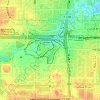
Name: USA topographic map, elevation, terrain.

Location: USA, Arlington, Tarrant County, Texas, 76011, United States (32.75630 -97.06880 32.75640 -97.06870)

Average elevation: 170 m

Minimum elevation: 150 m

Maximum elevation: 184 m

Gear up for your next adventure:

🥫Freeze-Dried Meals - Lightweight, high-calorie nutrition for multi-day treks
🔦LED Headtorch - Bright and durable light for night activities
🥾Trail Hiking Socks - Comfortable socks to prevent blisters and fatigue
🍽️Titanium Camping Spork - Ultralight and indestructible eating utensil
🎒Hiking Daypack - Lightweight and durable backpacks for day trips and excursions

As an Amazon Associate, this site earns from qualifying purchases at no extra cost to you.